Where will they fly?
Revised 6/19/98
The question we are asked most frequently is, "Will the planes fly over my home?"
The county keeps changing the answer to this question as the airport plan goes through a series of redesigns - and as the county seeks to deflect community opposition to an airport at El Toro.
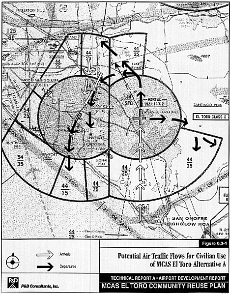
The "official" flight paths are incorporated in the Environmental Impact Report and Community Reuse Plan. Heavier planes, including night cargo flights are shown taking off to the north-west over central- and north-county communities like Tustin, Orange, Villa Park and Yorba Linda.
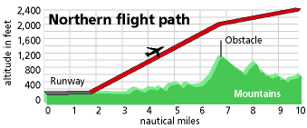
In 1998, the county proposed that north takeoffs would go straight north over the mountains, despite the fact that the Loma Ridge, in that direction, was the scene of the worst air crash in county history. The county's proposal for takeoffs straight north has yet to receive the endorsement of the FAA or pilots organizations. To date, county published information has assumed that all engines are operating normally. County planners have yet to provide an emergency procedure for handling an engine failure on takeoff into the mountains.
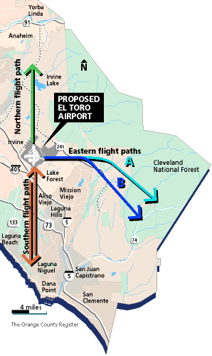
The county intends that 70% of takeoffs will be to the east into other mountainous terrain. Both the Air Line Pilots Association and the Allied Pilots Association have objected for safety reasons. Click here for pilots comments on easterly takeoffs.
The county has proposed two different easterly takeoff paths. Click here for the latest published information on the east takeoffs, as well as a general map of the flightpaths.
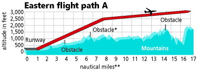
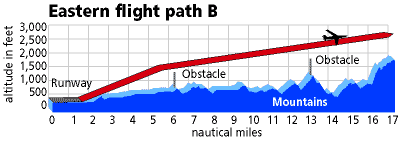
Click here for information on altitudes over obstables to the east for Plan A and Plan B.
Click here to see the noise footprint for flight paths as presented in the EIR.
We suggest that you start here, and then read what the pilots have to say.